Fishers Island Conservancy
  • Home
  • Who We Are
    • Our Mission
    • Our History
    • Our People
    • Contact Us
  • What We Do
    • Shorebird Monitoring
    • Annual Bird Counts
    • Marine Debris Clean Up
    • Island Sentinels
    • Research and Survey Team
    • Grassland Restoration
    • Mosquito Control
    • Invasive Plant Management
  • How To Help
    • Donate
    • Join Us
  • News
  • Events
    • Calendar
Sunday, August 30, 2026
Fishers Island Conservancy
  • Home
  • Who We Are
    • Our Mission
    • Our History
    • Our People
    • Contact Us
  • What We Do
    • Shorebird Monitoring
    • Annual Bird Counts
    • Marine Debris Clean Up
    • Island Sentinels
    • Research and Survey Team
    • Grassland Restoration
    • Mosquito Control
    • Invasive Plant Management
  • How To Help
    • Donate
    • Join Us
  • News
  • Events
    • Calendar
Fishers Island Conservancy
  • Home
  • Who We Are
    • Our Mission
    • Our History
    • Our People
    • Contact Us
  • What We Do
    • Shorebird Monitoring
    • Annual Bird Counts
    • Marine Debris Clean Up
    • Island Sentinels
    • Research and Survey Team
    • Grassland Restoration
    • Mosquito Control
    • Invasive Plant Management
  • How To Help
    • Donate
    • Join Us
  • News
  • Events
    • Calendar
Copyright 2026 - All Right Reserved
Current EventsEventsNews

An Invasive Spotted Lanternfly Was Found on Island – Time to Take Action!

by Anna White August 12, 2026

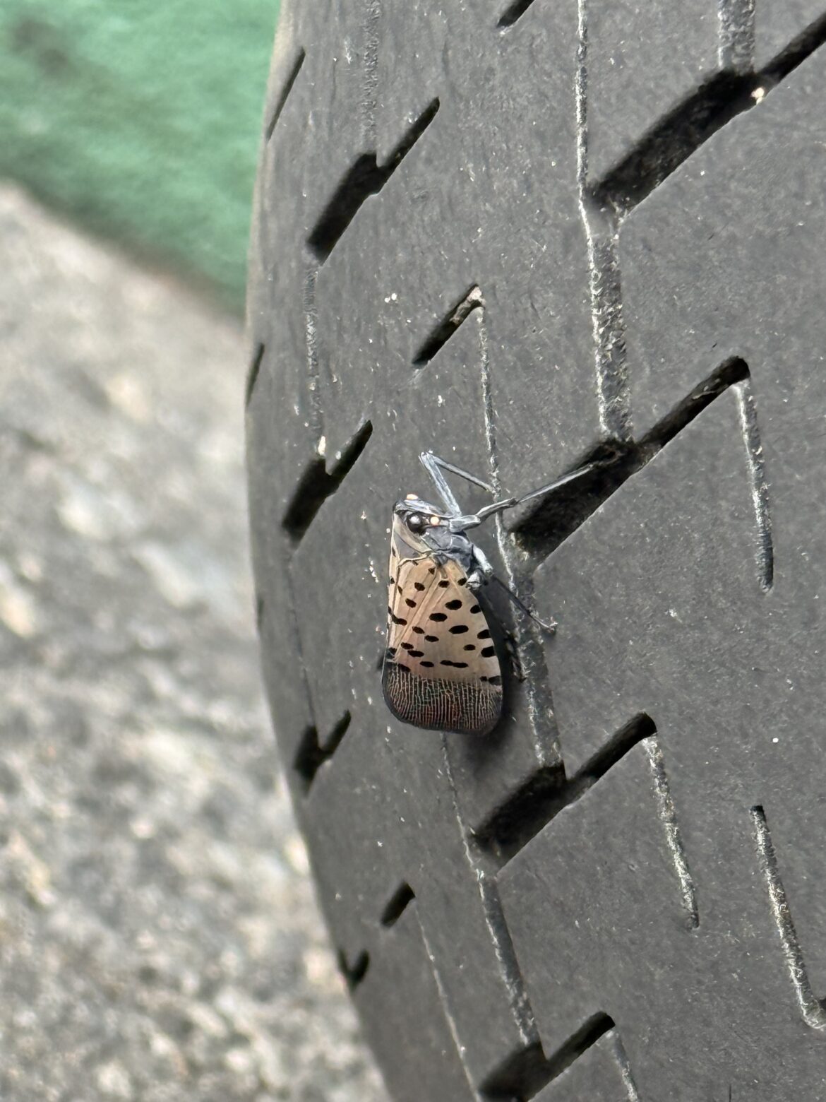
Yesterday, a Spotted Lanternfly (Lycorma delicatula) was found on island. Evan, one of the assistant pros at the Big Club, noticed the insect flying around 6:00 PM, watched it land on the tire of a golf cart, photographed it, and killed it right away. This is likely one of the first confirmed sightings of this species on the island, and it’s an important one to pay attention to.

Thank you, Evan, for identifying it and getting rid of it right away!
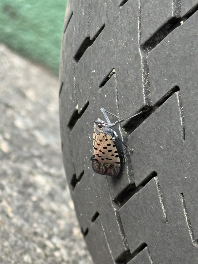
Photo by Evan Massena 

The invasive Spotted Lanternfly (Lycorma delicatula) has been spreading throughout the Northeast, including southeastern Connecticut. By September 2025, established populations had been documented in New London County, making its eventual arrival on Fishers Island an important possibility to prepare for. Spotted Lanternflies can also hitchhike on vehicles, boats, equipment, and other materials, allowing them to spread into new areas. (Learn more here)

Beyond being a general nuisance, Spotted Lanternfly is a serious pest of grapes and hops, and can also damage a wide range of other plants. The more established it becomes, the harder and more costly it is to manage.
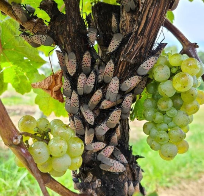
Photo credit: PennState 

What to look for

Spotted Lanternflies lay egg masses that can be just as important to spot as the insect itself. Egg masses are often found on tree bark, stone, or outdoor equipment and can be easy to overlook if you don’t know what they look like. 
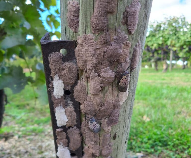
Photo credit: City of Philadelphia 

Why Tree-of-Heaven matters

One of the most important plants associated with Spotted Lanternfly is another invasive species already found on Fishers Island: Tree-of-Heaven (Ailanthus altissima). Lanternflies can feed on many different plants, but Tree-of-Heaven is a preferred host, and feeding on it actually makes the insect more toxic, since it absorbs compounds from the plant into its own tissue. That toxicity helps protect the lanternfly from predators. Where Tree-of-Heaven isn’t present, the insect is less protected and more vulnerable to natural predation.

That means removing Tree-of-Heaven from your property isn’t just good invasive plant management on its own, it can directly weaken the lanternfly’s foothold here!

Look for very large compound leaves made up of many individual leaflets, often giving the tree a tropical or almost palm-like appearance. The leaflets have smooth edges with one or more small teeth or glandular bumps near their base. When the leaves or young stems are crushed, they often produce a strong, unpleasant odor, sometimes compared to burnt or rancid peanut butter.

Tree-of-Heaven is commonly confused with native sumacs, and getting the identification right matters, since sumacs support species like the hickory horned devil caterpillar that we want to protect. Please take care to correctly identify a plant before removing it. 
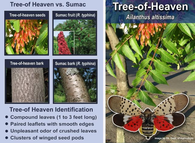
Photo credit: Delaware Forest Service 

The FI Conservancy and Fishers Island Research and Survey Team (FIRST) will continue monitoring for this unwelcome guest and the invasive plants that may help support it. It’s time to take action so we don’t see more of them spread across the island. 

Have you seen one?

Please report any sightings of Spotted Lanternflies, egg masses, or Tree-of-Heaven so we can track how widespread this is.

Contact Tyler at tyler.mcmahon@go.tarleton.edu to report a sighting or ask questions. Please also report directly to New York State using the NY Dept. of Agriculture & Markets reporting form.
August 12, 2026 59 views
News

Summer by the Numbers 2026

by Anna White August 30, 2026

Marine Debris

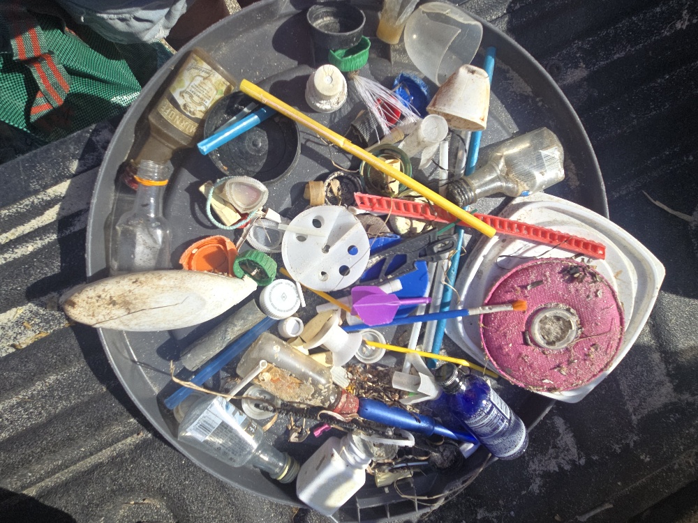
If you’ve spent any time on Fishers Island’s beaches, you’ve probably noticed how clean our shoreline is.. That’s largely thanks to Michele Klimczak, our Marine Debris Coordinator, who runs our program that’s grown into regular cleanups paired with real data collection and tracking across the island. Every piece that gets picked up is weighed, logged, and tied to a specific zone, which sounds a little tedious, but it’s actually what makes this program more than just cleanup. That data tells us where debris tends to pile up, whether certain storms or seasons bring in more of it, and how this work is making a dent over time.

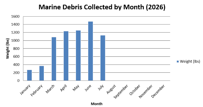
Collected by Month

Debris collection stayed relatively light through the winter and climbed steadily as the weather warmed and beach traffic picked up. June was the summer’s biggest month so far, with 1,473 pounds collected, and July followed closely behind at 1,133 pounds. Combined, that’s already over 2,600 pounds pulled off the island’s beaches across just those two months. 

So why is it such an increase in debris heading into summer? A few factors likely play into it. Warmer weather brings more people to the island’s beaches, which naturally means more foot traffic and more opportunity for debris to accumulate along the shoreline. At the same time, summer is peak season for boating and fishing activity throughout Long Island Sound, both locally and along the Connecticut coastline, and that increased activity tends to bring more lost or discarded gear, traps, lines, and buoys, washing ashore. Warmer months can also mean more frequent storms and stronger tidal patterns, which can carry debris in from further offshore. Together, these seasonal shifts in both human activity and ocean conditions likely explain why debris totals climb through the summer months. 

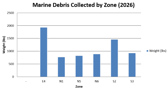
Collected by Zone

To understand why some zones collect more debris than others, it helps to know what each one covers. 

N1: Airport Beach, Silver Eel Cove, Little Stony, Hay Harbor Club Beach, Holiday House

N6: South Dumpling Beaches, Grey Gulls, Beach at Stables, Dock Beach, North Hill

N5: Clay Point Road Beaches, Chocomount Cove, Hungry Point, East Harbor

E4: Latimer Light Beach, Beaches to Left of Castle Road, Houghton Beach, Beaches Behind Money Pond

S2: The Race, Sanctuary of the Sands, South Beach, Wilderness Point, Isabella Beach

S3: Chocomount Beach, Beach Before Fishers Island Club

Zone E4 has consistently pulled in the most debris this summer, and its position helps explain why. Sitting at the eastern tip of the island, it’s directly exposed to the confluence of Long Island Sound and Block Island Sound, an area where converging currents from multiple directions tend to concentrate floating material rather than carry it past. Zones S2 and S3, both on the island’s south-facing shoreline, aren’t far behind, likely because they’re more exposed to open water and prevailing wind and wave patterns coming up from Block Island Sound, compared to the more sheltered north shore zones like N1, N6, and N5. 

FIRST Research Team

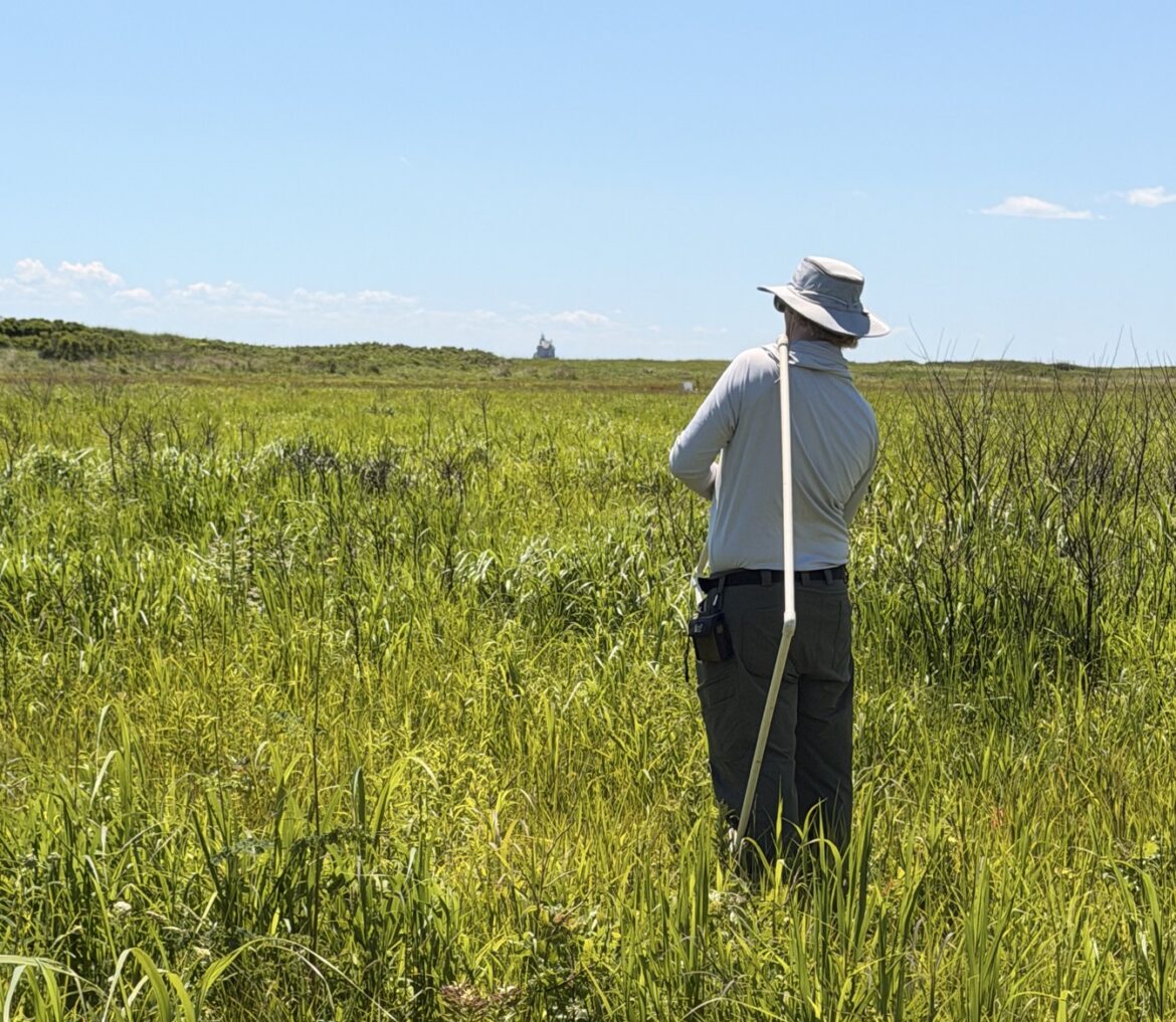
The Fishers Island Research and Survey Team (FIRST), a partnership between the Conservancy and Tarleton State University, spent another summer in the field collecting data across the island, on birds, insects, plants, and soil, that will help guide conservation decisions for years to come.

By the Numbers

  • Plant-insect study, now complete after 3 years: 15 transects, 150 pitfall traps, 75 vacuum samples, and 75 vegetation plots collected this season alone, wrapping up a three-year effort to track plant and insect communities across Conservancy properties. This dataset will eventually be compared to similar research from about a decade ago, offering a rare look at how the island’s biodiversity has shifted over time. 
  • Breeding bird surveys, June and July: 42 species documented during the June 14th survey, including a Scarlet Tanager and Willow Flycatcher among the highlights. That number jumped to 52 species and 228 individual birds during the July 25th survey, conducted across 15 survey points using a mix of visual ID and confirmed vocalizations. Because breeding birds respond quickly to changes in habitat, these counts help track the health of the island’s nesting population year over year. 
  • Soil research (Natalie Sato): 250 topsoil samples collected on island, plus another 150 brought back to Grinnell College, as part of ongoing research into whether invasive knotweed leaves lasting chemical effects in the soil after removal. 
  • Arthropod research (Naomi Zahn): 10 vegetation plots, 20 pitfall traps, and 10 vacuum samples collected to study how mowing invasive knotweed affects the insects and spiders living in it.
  • Community volunteering: 36 hours logged across three events, Pollinator Pathways (8 hours), Ferry Park (24 hours), and FI Seagrass (4 hours).
  • Community survey: 160+ respondents so far to Tyler McMahon’s ongoing survey, with more responses still needed for a complete analysis.

Shorebird Monitoring

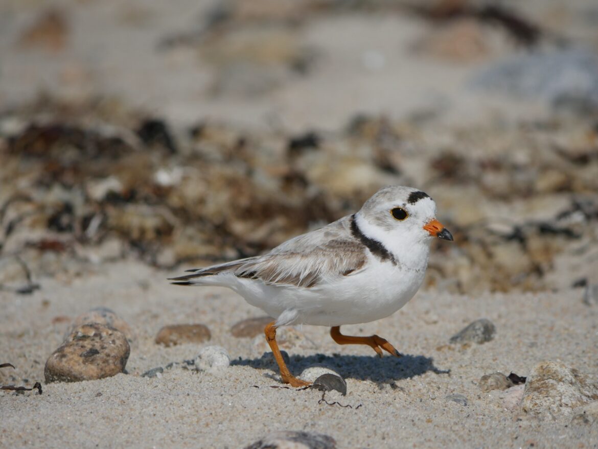
Piping Plover and Least Tern monitoring on island is run by our Field Director, Anna White, in collaboration with the NYSDEC and the Long Island Colonial Waterbird and Piping Plover Survey. Here’s a look at what this season’s numbers added up to…

By the Numbers (2026 Season)

  • 4 active monitoring sites this season: Eighth Hole Beach, Big Club Beach, Middle Farms Beach, and South Beach, each tracked throughout the nesting and chick-rearing period. 
  • 22 Piping Plover eggs laid across the island, with 17 chicks hatched and 9 confirmed fledged. That works out to a 77.3% hatch rate and a 52.9% fledge rate, or an overall productivity of 1.8 chicks fledged per breeding pair, a solid number for a species facing this many natural and human pressures each season!
  • Big Club Beach had the standout turnaround of the year. After 0 nesting activity in 2025, a pair returned this season, hatched all 4 eggs from a full clutch, and fledged 3 of the 4 chicks, a big jump in productivity for a site that had struggled in recent years. 
  • Middle Farms Beach delivered the cleanest season of any site. A single pair hatched 3 chicks from a full clutch of 4, and all 3 made it to fledging with no documented losses. The site’s natural shelter and lower foot traffic likely played a role in that outcome.
  • Eighth Hole Beach hatched a full clutch, but had a harder road to fledging. All 4 eggs hatched successfully, but only 1 chick made it to fledging this season. The site faces recurring pressure around the July 4th holiday from heavy boat traffic and beachgoers, and this year’s brood also dealt with weather and predation challenges during the chick-rearing period.
  • South Beach was a site of mixed outcomes this season. Two Piping Plover pairs nested there across three nest attempts, together hatching 6 chicks and fledging 2. At the same time, the site’s Least Terns had their best season yet, with 5 fledged chicks between the pairs tracked there and a nest discovered partway through the season, more than any other site or species combination this year.

Photo by Naomi Zahn

Island Sentinel Program

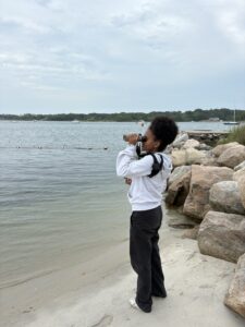
For over a decade, the Island Sentinel Program has been one of the Conservancy’s longest-running youth stewardship programs, connecting local knowledge with hands-on conservation work and giving youth a role in observing and caring for our islands natural environments. Over the years, Sentinels have documented everything from wildlife and shoreline conditions to marine debris and seasonal ecological change across the island’s monitoring sites. In 2025, a significant effort went into reviewing that historical dataset, and one thing stood out clearly- over 70% of everything ever recorded was bird-related. 

That finding shaped a deliberate shift for the 2026 season. Rather than continuing to track a wide range of categories, this year’s approach leaned into what the data showed was already the program’s strength: bird  observations. Sentinels were assigned specific sites to visit consistently, given standardized routes, and asked to record GPS coordinates at the start and end of each visit. By focusing more narrowly on birds and standardizing how that data gets collected, the program is aiming for the ability to compare biodiversity across sites, track seasonal patterns in which species are using different parts of the island, spot ecological shifts and notable events as they happen, and build a comparable, long-term record. Digital data collection and direct integration with the islands iNaturalist project reinforce that goal, giving every observation a timestamp, GPS location, and photo verification. None of this changes what the program has always been at heart, an approachable, hands-on way for the youth to get outside and pay attention to the island around them. 

By the Numbers

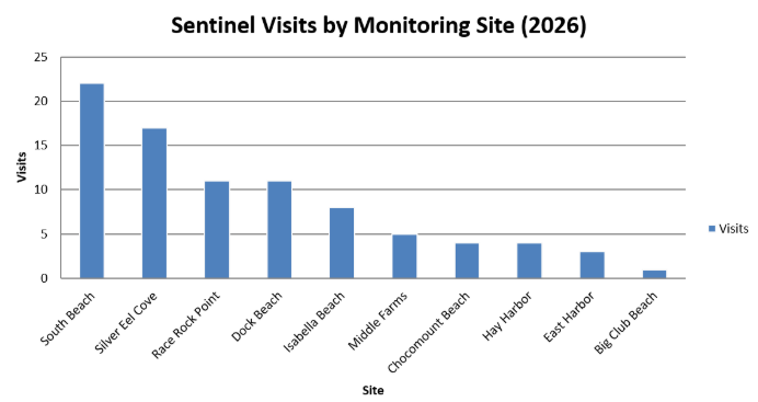
This season, 3 Sentinels logged 86 visits across all 10 of the program’s official monitoring sites between June and mid-August, a strong first season for the program’s more structured, site-based approach.

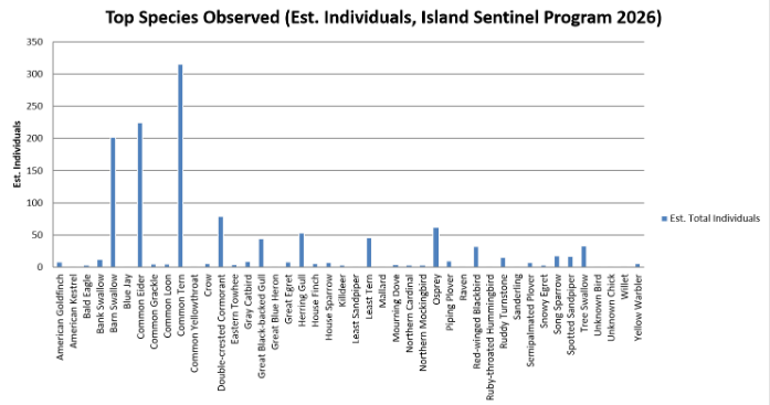
Those 86 visits added up to an estimated 1,266 individual birds observed, spanning 42 unique species across the island. That’s an impressive amount of data for one season, and it’s exactly the kind of consistent, wide-ranging coverage the program’s 2026 changes were designed to produce.

The program’s 10 monitoring sites, Silver Eel Cove, Race Rock Point, South Beach, Hay Harbor, Dock Beach, Isabella Beach, Middle Farms, Chocomount Beach, Fishers Island Club Beach, and East Harbor, represent a mix of beaches, harbors, shoreline areas, and pond environments established over the program’s history to give a broad, island-wide picture of wildlife activity. That said, coverage wasn’t even across every site. A few sites, like South Beach and Silver Eel Cove, saw far more consistent visits than others, while a couple of the more historically included sites saw only light coverage this season. As a pilot year for this more structured approach, that’s exactly the kind of information we wanted this season to surface. Going forward, we’ll be looking closely at which sites are producing consistent, useful data and which ones may need adjusting, whether that means expanding effort at high-value sites, reworking how a lower-traffic site gets monitored, or reconsidering whether every historical site still makes sense to keep in the rotation. The goal isn’t to lock in exactly 10 sites forever, it’s to make sure wherever Sentinels are spending their time is actually building toward that long-term, comparable record the program is working to establish.

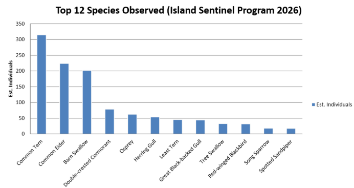
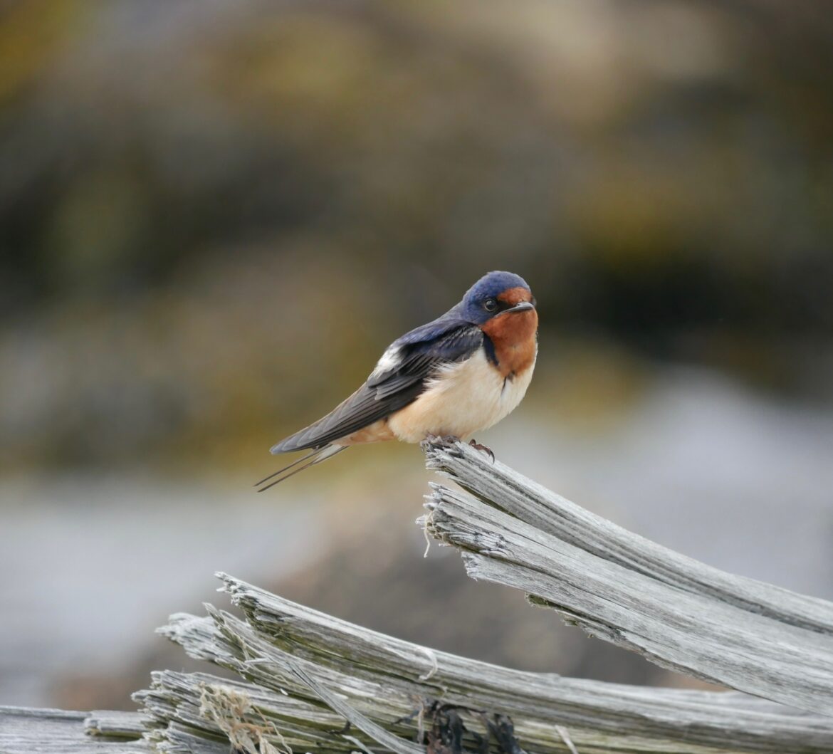
Common Tern, Common Eider, and Barn Swallow make up the largest share of individual birds recorded this season, and there’s an ecological reason behind that. All three are highly social or colonial species, meaning they naturally gather in large groups rather than being spread out individually across the landscape. Common Terns feed and roost in flocks, often diving together on schools of baitfish, which is exactly what drove two of this season’s biggest single counts, over 100 individuals recorded feeding together on more than one occasion. Barn Swallows behave similarly around structures like docks, where dozens can roost or forage together at once, which is why a single site visit could turn up 50 or more in one sighting. Common Eiders, meanwhile, gather in rafts on open water, especially outside of the breeding season, so a handful of sightings can easily account for a large share of the season’s total. These numbers aren’t showing that our island has an unusually dense population of these three species compared to everything else, they’re showing how flocking behavior concentrates individual counts around a small number of highly social species. That’s a normal and expected pattern in bird survey data, and it’s actually a good sign.Iit means Sentinels were in the right place at the right time to catch these species doing what they naturally do.

The rest of the list tells us about the range of habitats Sentinels are covering. Double-crested Cormorant, Osprey, and Herring Gull round out the next tier, all common, easily identified species that use the island’s beaches, open water, and rocky shorelines throughout the summer. Osprey in particular is a great indicator species to see well-represented, since its presence reflects a healthy local fish population and clean coastal water. Further down the list, species like Least Tern, Great Black-backed Gull, Tree Swallow, Red-winged Blackbird, Song Sparrow, and Spotted Sandpiper reflect the mix of shoreline, marsh, and upland habitat types the program’s 10 monitoring sites collectively cover. Having this many distinct species show up meaningfully across just one season, rather than the list being dominated entirely by two or three species, is a strong early sign that the more structured 2026 monitoring approach is capturing a slice of the island’s bird life, not just whatever happened to be easiest to spot.

Monarch Tagging Program (New Pilot Program)

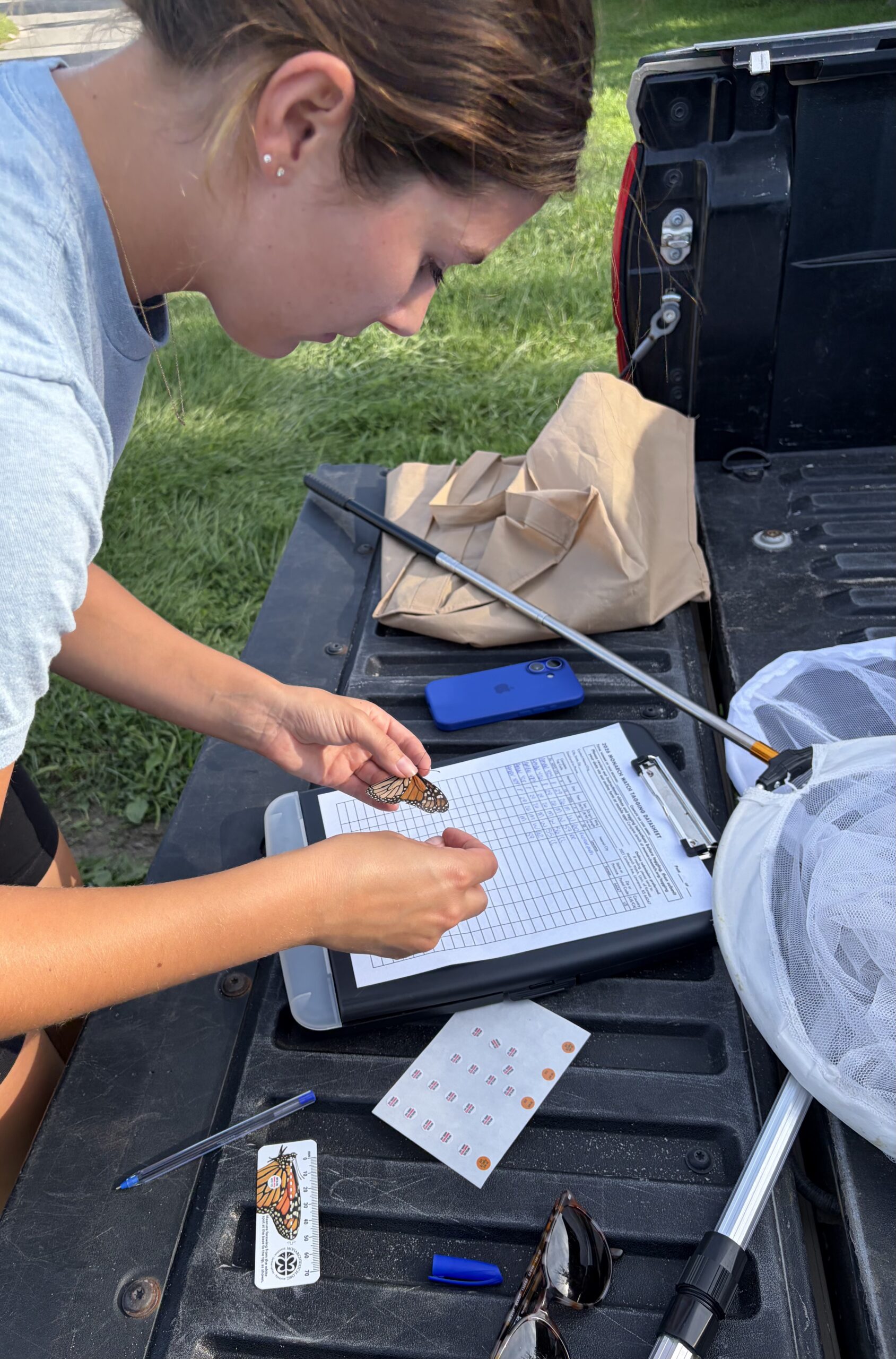
As summer winds down and fall gets underway, the Conservancy is exploring a brand-new pilot program: monarch tagging. The initiative was started by Kristen Peterson, working alongside Anna White, as a first-year effort to bring the Conservancy into Monarch Watch’s long-running national tagging program, a community science effort that’s been tracking monarch fall migration since 1992. As part of getting the pilot off the ground, Kristen and Anna have been scouting sites across the island with strong pollinator activity, prioritizing spots with abundant late-summer nectar sources like goldenrod and asters that attract monarchs as they fuel up for migration. Daily observation counts are being logged at these sites as part of Monarch Watch’s broader Calendar Project, tracking adult monarch activity throughout the season.

By the Numbers

  • Program window: August 22 – late September/October 2026 (first pilot season)
  • Average daily count: approximately 19 monarchs observed per day across monitored sites
  • Total tagged so far: 30 monarchs tagged by Kristen and Anna

Timing matters a lot with monarchs, and it comes down to which generation is passing through. The monarchs seen on island in late August aren’t part of the regular summer breeding cycle, which produces butterflies that only live a few weeks. Instead, this is the “super generation,” a special migratory generation that enters a state called reproductive diapause, meaning they pause breeding entirely and redirect all their energy into building fat reserves for a long journey south. This generation lives dramatically longer than a typical summer monarch, often 6-9 months instead of just a few weeks. Once they head out, these monarchs travel an extraordinary distance, up to 3,000 miles, all the way to the oyamel fir forests of central Mexico, where millions of monarchs from across eastern North America cluster together on tree branches and trunks for the winter. Come spring, that same generation breaks diapause, mates, and begins the journey back north, laying eggs along the way to start the next breeding cycle. Every tag placed on a monarch carries a unique code. If that individual is ever recovered, whether spotted along the migration route or found at the overwintering grounds in Mexico, researchers can match the tag back to exactly when and where it was released. That single data point helps build a bigger picture nationally: how fast the migration is moving, how far individual monarchs are traveling, survival rates along the way, and how the population is shifting year to year.

Thank you to everyone who made this summer possible! We couldn’t do any of this without you, and we can’t wait to see what next season brings.

August 30, 2026 7 views
FIRSTNews

That’s a Wrap for FIRST 2026

by Anna White August 13, 2026

The Fishers Island Research and Survey Team (FIRST) wrapped up another season of research, monitoring, and conservation work across Fishers Island this summer. From birds and bats to insects, plants, and soils, the team spent the season out in the field collecting information that will help us better understand how the island’s ecosystems are changing and how conservation efforts can support them into the future.

Much of this summer’s data is still being processed, but a few long-term projects reached real milestones this year. Here’s a look back at what FIRST accomplished during the 2026 season.

One of the biggest was the completion of FIRST’s three-year plant-insect study, which looks at plant and insect communities across Conservancy properties. This season alone, the team completed 15 transects, 150 pitfall traps, 75 vacuum samples, and 75 1×1 meter vegetation plots. Now that all three years of data are collected, Tyler will begin analyzing the full dataset, and results are expected to be shared with the community over the coming year. This dataset will eventually be paired with similar research conducted about ten years ago, giving us a rare chance to see how Fishers Island’s habitats and biodiversity have changed over the past decade, and how ongoing restoration and management may be shaping those changes.

The team also continued our annual breeding bird surveys, conducted throughout June and July this year, documenting which species are using different habitats across the island and adding to a growing dataset that helps track the island’s breeding bird community over time. Data from these migratory bird counts will also begin formal analysis this year, looking at population trends and functional guilds over the past 14 years.

Bat monitors were deployed again this summer, but the team is holding off on reporting species identifications until they’re fully confident in the calls captured. Tyler will be visiting a collaborator in late August or early September to confirm the IDs, and we’ll share those results once they’re finalized.

Naomi Zahn’s continued research into Japanese knotweed’s effect on arthropod communities included sampling 10 1×1 meter plots, with 20 pitfall traps and 10 vacuum samples collected across those sites. This work looks beyond the invasive plant itself to examine how it affects insect communities nearby, helping us understand how invasion and management ripple outward into the broader ecosystem.

Natalie Sato’s project investigating the lingering effects of knotweed on soil chemistry involved around 250 topsoil samples collected on island, with an additional 150 soil samples she brought back to Grinnell for further analysis. A new project also got underway investigating the island’s seed bank, the dormant seeds sitting in the soil that could play a role in native plant recovery after restoration and invasive removal work.

Not everything FIRST built this summer was research data. The team also started a “Plants of Fishers Island” pressed-plant collection, preserving examples of plants found across the island as a lasting educational and identification resource for the community.

Beyond their research, FIRST students volunteered across three major community events this summer: two days at Pollinator Pathways (8 hours), four days at Ferry Park (24 hours), and one day with FI Seagrass (4 hours).

Piping Plover and Least Tern monitoring on Fishers Island is run by our Field Director, Anna White, in collaboration with the New York State DEC and the Long Island Colonial Waterbird and Piping Plover Survey . This summer, the FIRST team pitched in to help with that monitoring work, supporting the surveys as the season went on. One site is still being monitored as this season wraps up.

Sharing Their Research on Island

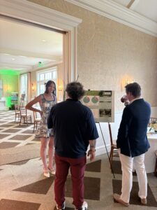
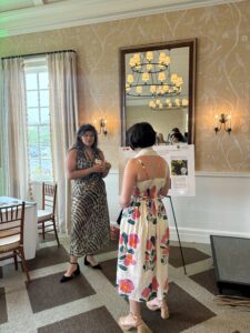
On July 18th, FIRST students Naomi Zahn and Natalie Sato shared their independent research projects with the community, presenting the posters they’d been building all season.

Naomi presenting her poster

Naomi’s project looked at how mowing invasive Japanese knotweed affects the insects, spiders, and other arthropods living in it. Working across nine sites on Fishers Island, she compared arthropod communities before and after mowing using pitfall traps and vacuum sampling. Her results showed that while mowing didn’t change the overall diversity of arthropods present, it did shift which types were most common, with mowed areas showing more plant-eaters and predators, a shift that can ripple outward and affect things like pollination and nutrient cycling. 

Natalie’s project asked a different question: does knotweed keep affecting the soil even after it’s gone? Her work explores allelopathy, a process where invasive plants release chemicals into the soil that can suppress native plant growth long after the invader has been removed. Natalie collected soil from four types of sites around the Parade Grounds, ranging from actively knotweed-invaded to native reference grassland, and is growing native black-eyed Susan and Virginia wild rye in each soil type to see how well they germinate and grow. Half of each soil sample was also treated with activated carbon, which absorbs these harmful chemicals, helping the team confirm whether lingering knotweed chemistry is actually the cause of any differences. Her results could help guide how restoration efforts on the island approach reseeding after invasive removal in the future.

Congratulations, Naomi!

This was Naomi’s third and final summer with FIRST, and this summer she graduated from Tarleton State University. We’re so grateful for everything she’s contributed to this program over the years, and we can’t wait to see where her career in wildlife biology takes her next!

The FIRST team wrapped up their season and departed the island on August 2nd. Some of this year’s projects are just beginning, while others are wrapping up several years of fieldwork and moving into analysis. Together, these studies are building a long-term picture of Fishers Island’s plants, insects, birds, bats, soils, and habitats, information that will help guide conservation decisions for years to come.

Thank you to our FIRST students for another season of hard work, and to the Fishers Island community for continuing to support research, education, and conservation on the island!

August 13, 2026 42 views
News

July 2026 Breeding Bird Count

by Anna White August 7, 2026

On Saturday, July 25th, the FI Research and Survey Team (FIRST) conducted a breeding bird survey across the island. The survey follows the same format as our classic migratory bird survey, but instead focuses on the birds currently nesting and raising young here on Fishers Island, outside of the migratory window. Unlike our migratory visitors passing through, these breeding residents will stick around for the next few months, relying on the island’s insects and other resources to feed and raise their chicks.

Working across 15 survey points, the team documented 228 individual birds representing 52 unique species. Birds were identified using a combination of visual observations and vocalizations. The Merlin Bird ID app assisted with some auditory detections, but recordings were reviewed and confirmed by the team before being included in the survey data.

Counts like these matter beyond the day itself. Because breeding birds respond quickly to changes in habitat and food availability, tracking them season after season helps us spot shifts in the island’s ecosystem early, and builds a long-term record of which species are successfully nesting here year to year.

The complete dataset from the survey is attached, and the species observed are listed below.

Featured Photo by Naomi Zahn 

July 2026 Breeding Bird Count
American Goldfinch
American Redstart
American Robin
Barn Swallow
Black-capped Chickadee
Black-crowned Night-Heron
Blue Jay
Carolina Wren
Cedar Waxwing
Chimney Swift
Chipping Sparrow
Common Eider
Common Grackle
Common Raven
Common Tern
Common Yellowthroat
Double-crested Cormorant
Downy Woodpecker
Eastern Towhee
Eastern Warbling-Vireo
European Starling
Gray Catbird
Gray Flycatcher
Great Black-backed Gull
Great Blue Heron
Great Crested Flycatcher
House Finch
House Sparrow
Killdeer
Mourning Dove
Northern Cardinal
Northern Flicker
Northern House Wren
Northern Mockingbird
Orchard Oriole
Osprey
Piping Plover
Purple Martin
Red-bellied Woodpecker
Red-winged Blackbird
Ring-billed Gull
Ring-necked Pheasant
Ruby-throated Hummingbird
Song Sparrow
Tree Swallow
White-breasted Nuthatch
White-eyed Vireo
Willet
Willow Flycatcher
Wood Thrush
Yellow-breasted Chat
Yellow Warbler
August 7, 2026 57 views
Marine ReportsNews

Marine Debris Report – July 2026

by Anna White August 4, 2026

Marine Debris July 2026

beaches,

Total lbs = 1,133 / Total hours = 188
~ Michele Klimczak

DATEZONELOCATIONWEIGHT (LBS)HOURS
7/1/2026E4Latimer Light up to East Harbor beaches 448.5
7/2/2026N5East Harbor beaches, Hungry Point through Chocomount cove beaches386.5
7/3/2026N6Clay Point Rd. beaches to Brick Yard Rd. to Dock beach to North Hill468
7/6/2026N1Holiday House beaches to Little Stony to Silver Eel Cover, Ferry Park, Ordnance to Airport beaches398.5
7/7/2026S2The Race through Sanctuary of Sands to South beaches up to Wilderness Point388.5
7/8/2026S2Wilderness Point beaches to Vikings End through the far end of Isabella beach548.5
7/9/2026S3Chocomount beaches before Big Club beaches (Barley Field Cove)416.5
7/10/2026E4Behind Money Pond to Castle to Latimer Light beaches lobster pot538.5
7/11/2026N5East Harbor, Hungry Point to end of Chocomount Cove395
7/13/2026N6North Hill to Dock, Brickyard Rd. beaches, Grey Gulls to Clay Point Rd beach488.5
7/14/2026N1Airport beaches to Ordinance to ferry Park to Silver Eel Cove to Little Stony Beach behind Holiday House428
7/15/2026S2Race Rock through Sanctuary of Sands beach to Wilderness Point468.5
7/17/2026S2Vikings End through Isabella beaches293
7/17/2026S3Chocomount beaches one end to the next 895
6/17/2026N5Hungry Point beaches through Chocomount Cove beaches.437.5
7/18/2026S3Beaches before Big Club283
7/18/2026-Organize trash at shed for Nature Day-2
7/20/2026E4Beaches over course right after big club, golf balls, broken lobster pots, buoys1068
7/21/2026E4Behind Money Pond through Castle, all Latimer Light beaches up to East Harbor638.5
7/22/2026N5East Harbor to Hungry Point through Chocomount Cove beaches up to Clay Point Rd528
7/23/2026N6Clay Point Rd beaches , Dock to North Hill beaches376.5
7/24/2026N1Airport beaches to Ordinance, Ferry Park, Silver Eel Cove, Little Stony Beach, Holiday House 348
7/27/2026S2Far end of South Beach before Wilderness Point to South Beach to Sanctuary of Sands to Race Rock 428
7/28/2026S2Wilderness Point (broken pot) through Vikings End and all of Isabella beaches 468
7/29/2026S3Chocomount beaches to beach before Big Club and then sorting at shed/ transfer - 3 hours369
7/30/2026-Work in my shed, continue emptying and sorting big items in truck from this week, compost station drop, working on Nature Day items -6
7/31/2026-Setting up pots, ropes, boat parts, etc. for Nature Day-4

View Debris Photo Gallery Here!

August 4, 2026 67 views
HorseshoeCrabsNews

Horseshoe Crab Monitoring Season Wrap-Up

by Anna White July 6, 2026

A Field Update from Stephanie Hall, FI Conservancy
June 27, 2026

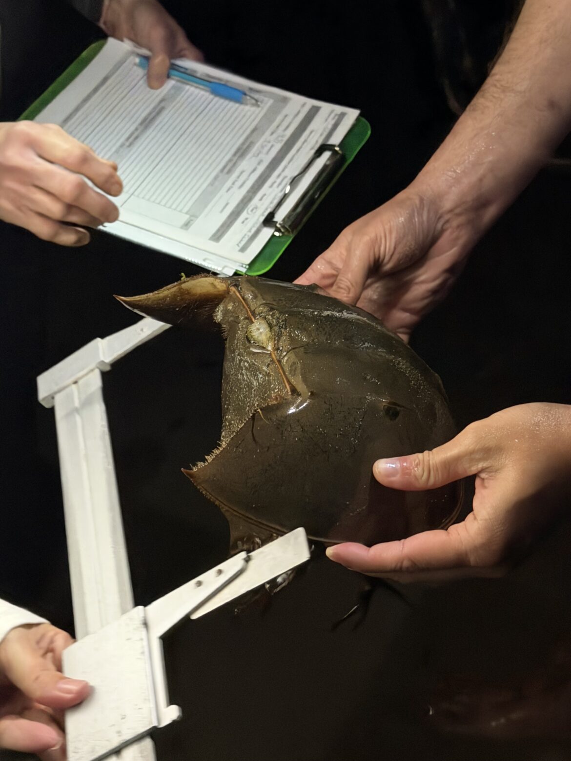
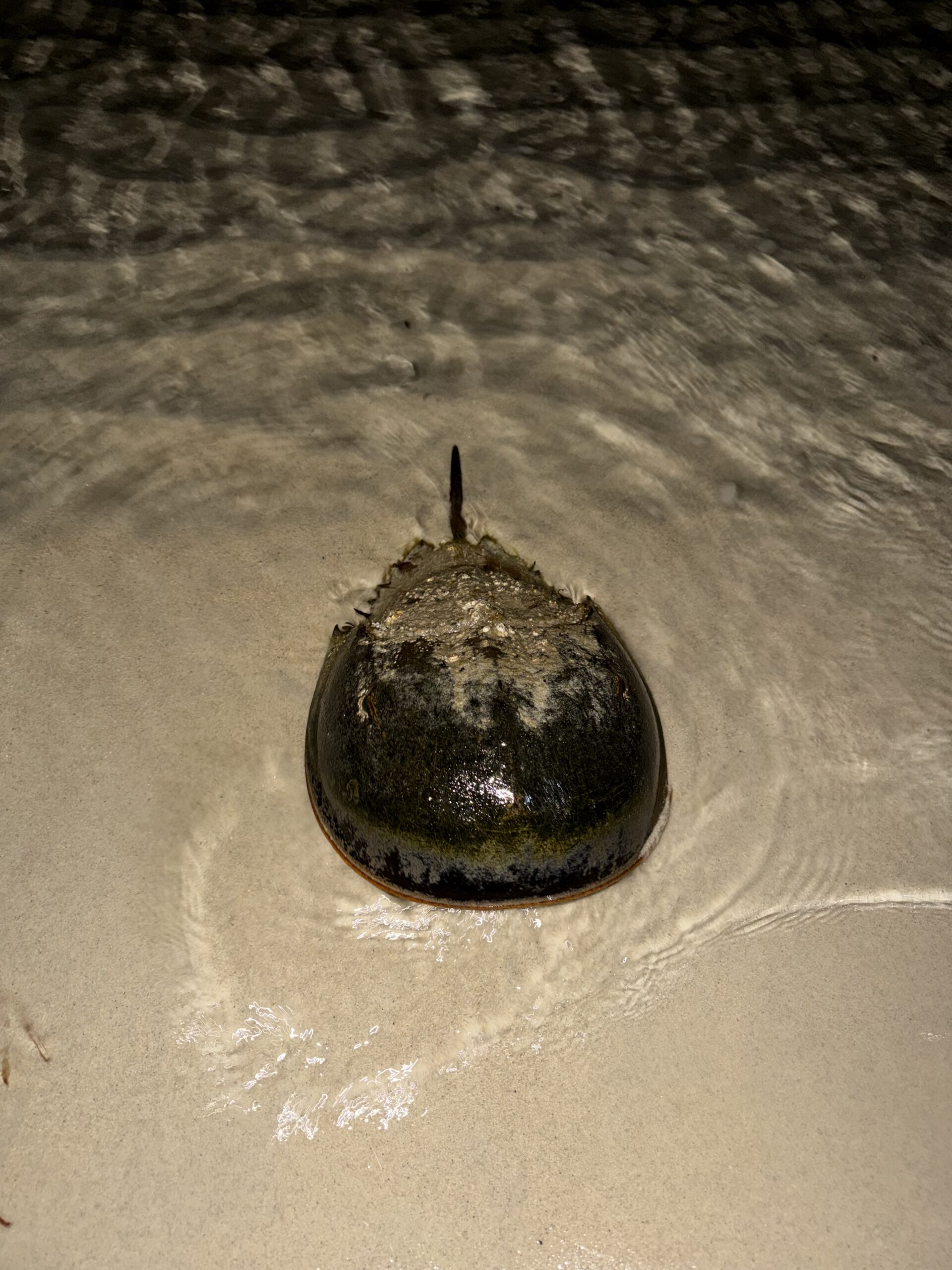
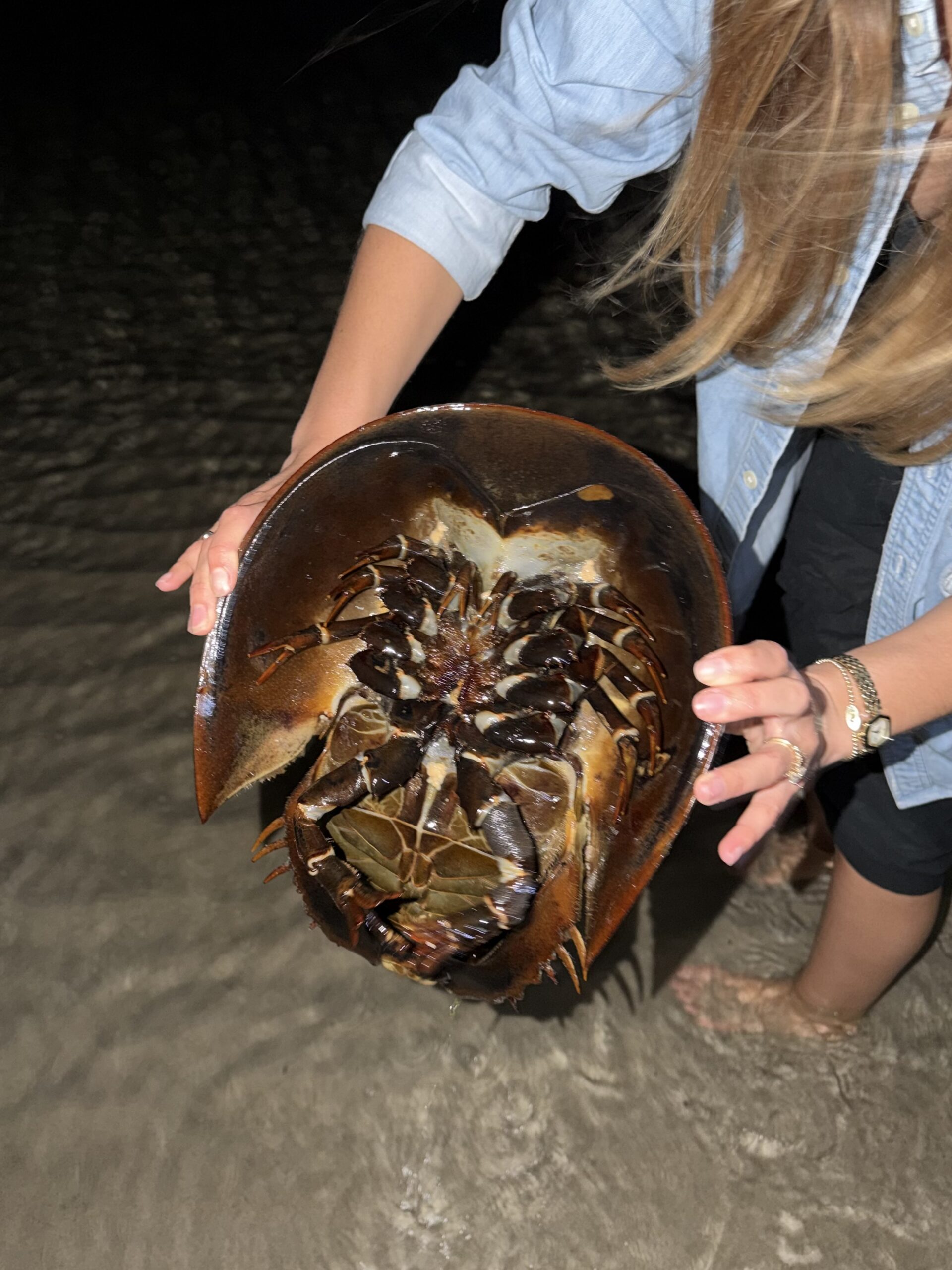
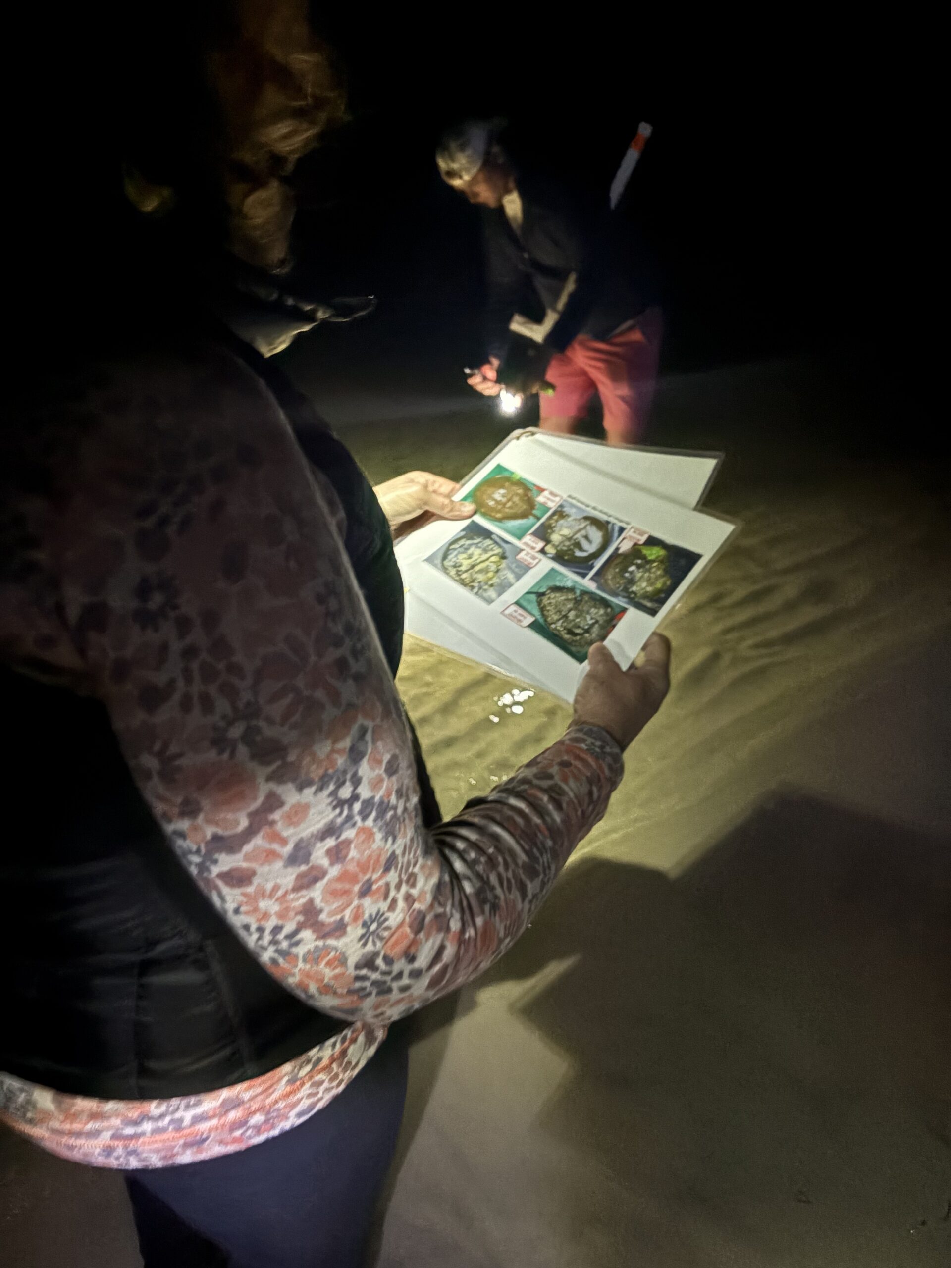
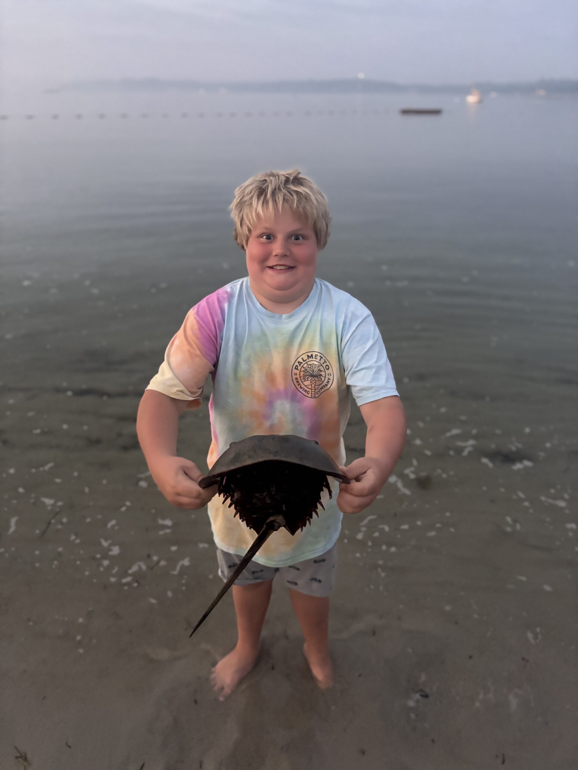
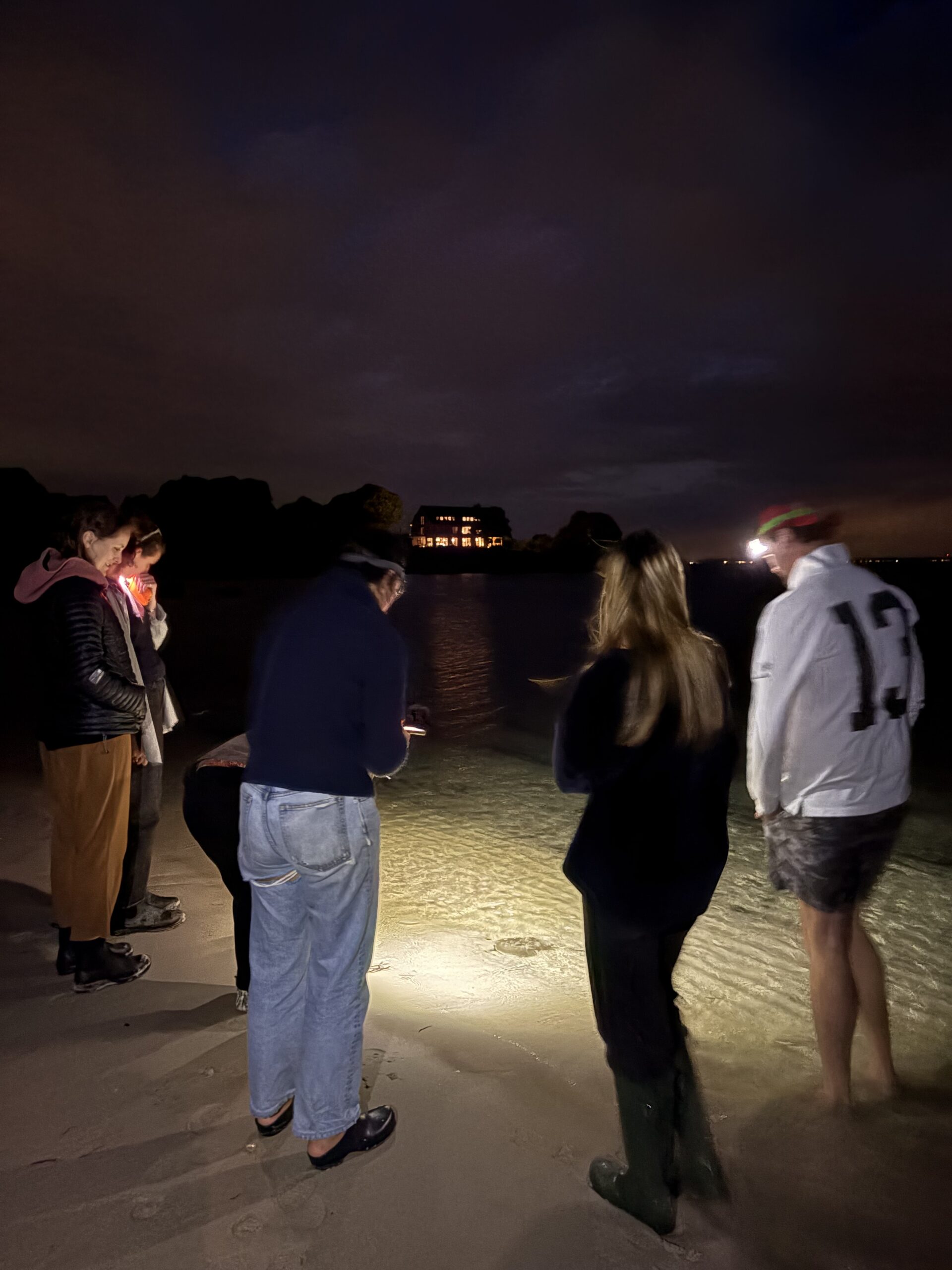
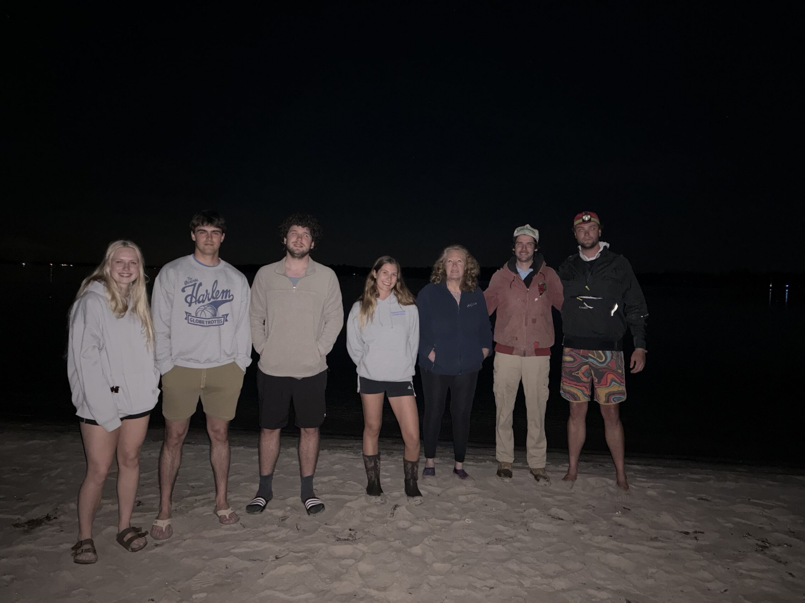
What a season it has been! The 2026 Horseshoe Crab monitoring program has wrapped up another successful year on Fishers Island, and it has been such a joy to see the level of community involvement and genuine curiosity around these incredible marine arthropods.

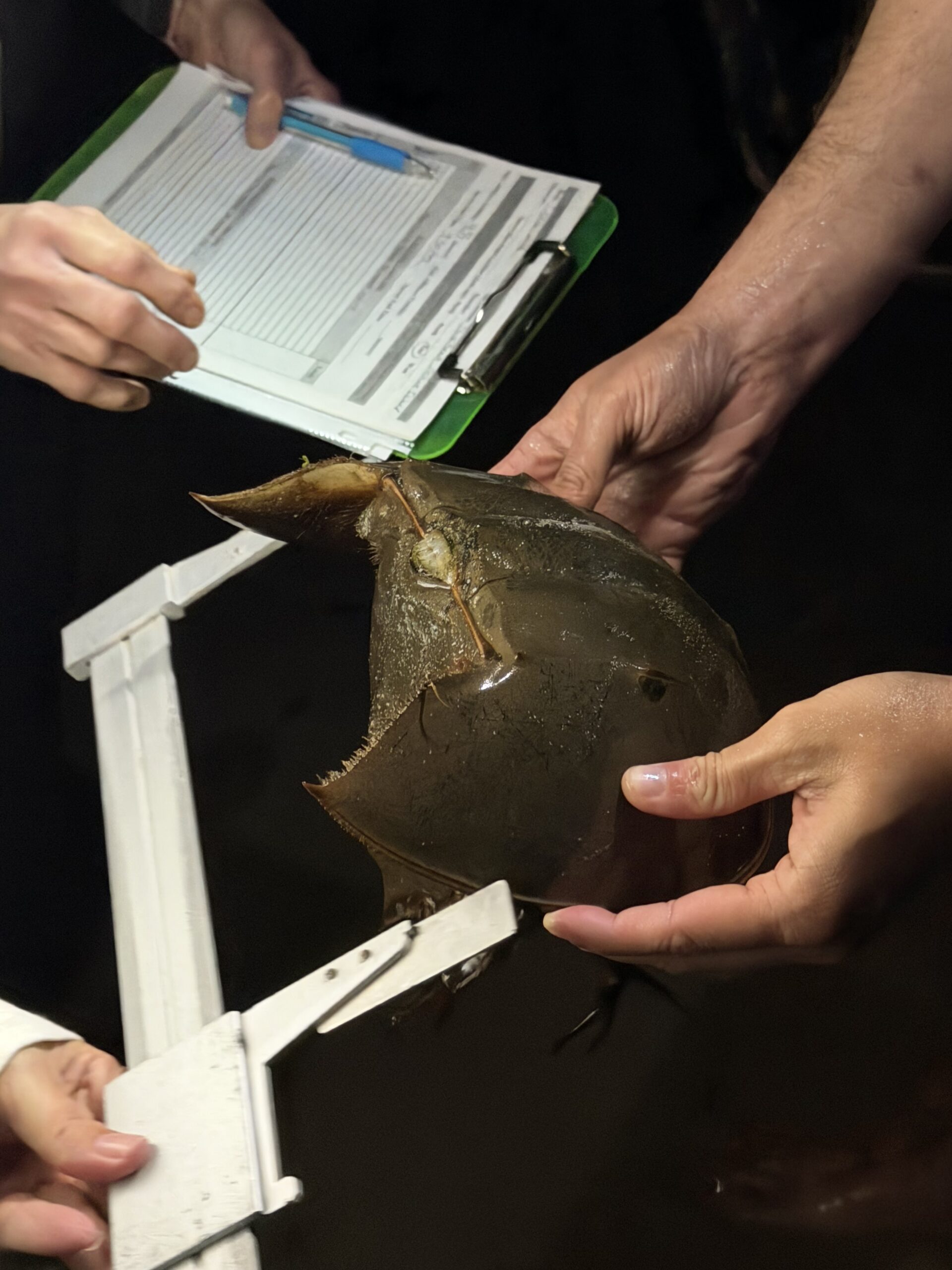
This year we recorded 154 Horseshoe Crabs compared to 147 cumulative counts in 2025, an encouraging uptick that mirrors what sites across the region are seeing. Stephanie notes that many Long Island sites, especially Jones Beach, are reporting record numbers this year.

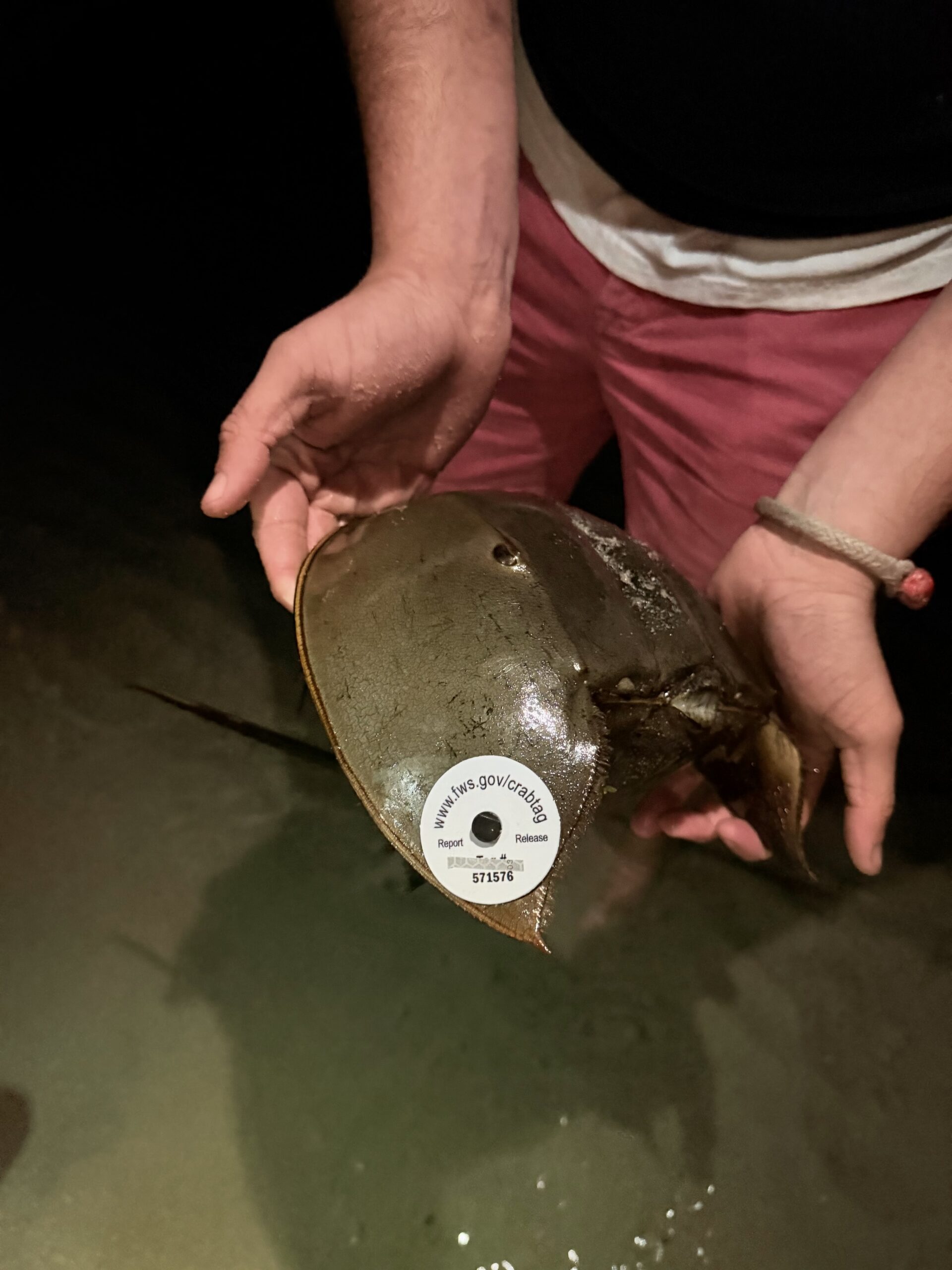
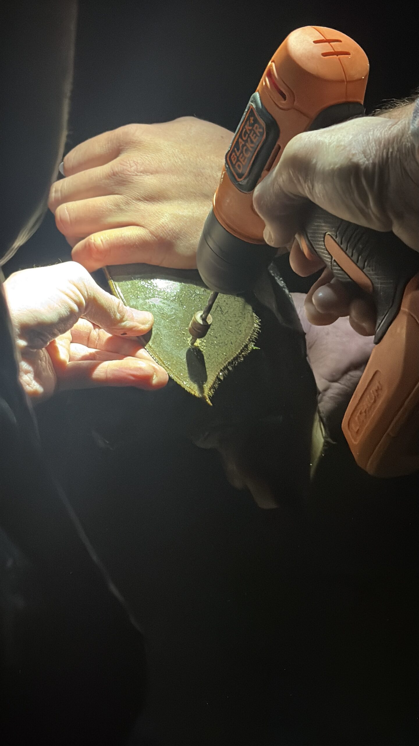
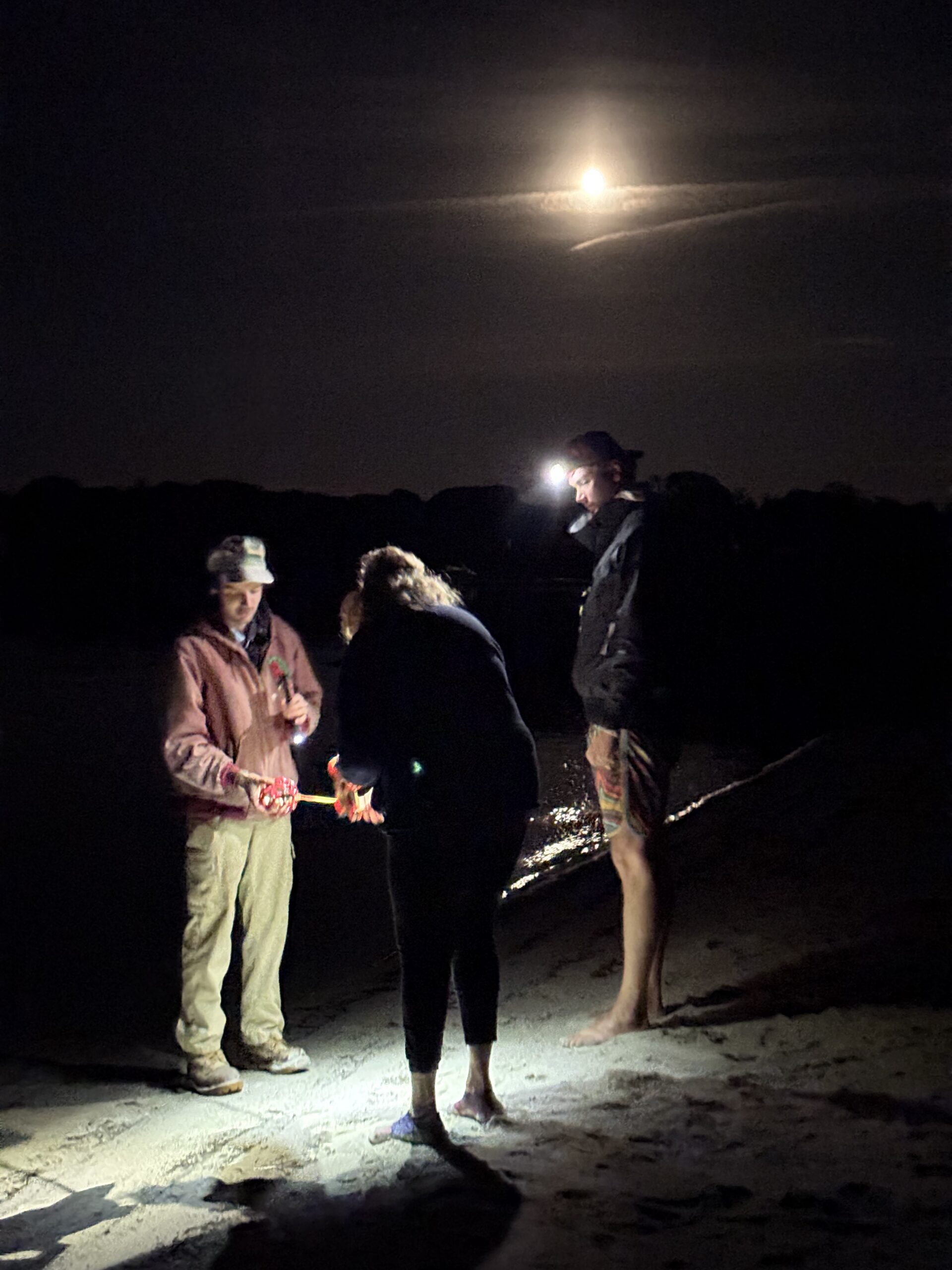
Some standout moments from the season include tagging 19 individuals, including 7 in a single evening which set a new site record! The team also recorded 12 recaptures, meaning previously tagged individuals that showed back up. This kind of data is especially valuable because it helps researchers track survival rates and migration patterns over time. To put that in perspective, a Horseshoe Crab tagged in Maryland back in 2015 was recently reported at Jones Beach, and these animals can live anywhere from 20 to 40 years.

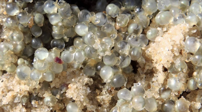
On the nesting side, hatching and larval development is now underway at Dock Beach. If you look closely at the sand near the water’s edge you may spot tiny clear egg sacs, smaller than a grain of rice, left behind by females who can lay up to 80,000 eggs in a single season. If you come across a nest please leave it undisturbed and give these ancient creatures the best chance to thrive.

Monitoring will continue for a few more nights as we close out the season. Thank you to everyone who came out and was part of it this year!

Stephanie Hall
FI Conservancy

Horseshoe crab eggs
July 6, 2026 150 views
FIRSTNews

A Mid-Season Update from FIRST

by Anna White July 3, 2026

Summer is in full swing on island, and the FI Research and Survey Team is deep into the field! Alongside their work with the Conservancy, each student gets to pursue their own independent research project tied to their college coursework, and this season they have brought some really exciting science to Fishers Island. Here is a look at what Naomi and Natalie have been working on this June and July! 

Natalie Sato – What Invasive Plants Leave Behind

Even after an invasive plant is removed, its effects on the soil may linger long after it is gone. Natalie is investigating this idea through the lens of allelopathy, a process by which invasive plants release chemical compounds into the soil that can suppress the growth of native plants nearby. Her focus is Japanese knotweed, one of Fishers Island’s more stubborn invaders, and whether the soil it leaves behind continues to inhibit native plant growth even after the knotweed itself has been removed or managed.

To test this, Natalie collected soils from four different site types around the Parade Grounds, areas actively dominated by knotweed, sites that have been mowed, sites that have been chemically treated, and native reference grasslands with little to no invasive presence. She is growing two native plant species, black-eyed Susan and Virginia wild rye, in cups packed with each soil type to measure germination success and plant growth over six weeks.

The experiment is housed in a raised bed near the native garden, which the team fully prepped for the project by pulling mugwort, transplanting remaining native vegetation, and replacing the soil with heat-treated topsoil. If Natalie’s hypothesis holds, plants grown in knotweed-invaded soils will germinate and grow more poorly than those in native soils, and the addition of activated carbon to the soil will help confirm whether those chemical compounds are the culprit. Her results could have real implications for how restoration efforts on the island approach reseeding and soil management after invasive removal.

Naomi Zahn – What Happens to the Bugs When the Knotweed Is Removed?

Now in her third year with FIRST, Naomi is continuing her investigation into Japanese knotweed’s impact on arthropod communities in the Parade Grounds. While a lot of invasive species management focuses on the plants themselves, Naomi’s work asks a different question: what happens to the insects, beetles, spiders, and other ground-dwelling creatures when knotweed is removed or disturbed?
This season, Naomi established ten sampling sites within areas of 100% knotweed cover, collecting arthropods from the foliage using vacuum sampling and deploying pitfall traps in the ground at each site. After getting her pre-mow samples in place, a small logistical hurdle came up when the mower typically used for the Parade Grounds went out of service. The team coordinated quickly with the Conservancy and Race Rock Garden Company to get it sorted out, and mowing ended up happening ahead of schedule, wrapping up over the weekend.

With the treatment now in place, Naomi has entered a one-month waiting period, giving the knotweed time to begin regrowing and the arthropod communities time to respond before she goes back in for a second round of sampling. The comparison between pre- and post-mow communities will help shed light on how management practices ripple through the food web in ways that are easy to overlook.

July 3, 2026 140 views
News

The Reason Our Beaches Look This Good

by Anna White July 2, 2026

If you have spent any time on our beaches, you know how special they are. Clean shorelines, clear water, and the kind of coastal beauty that feels increasingly rare. What most people do not know is how much work goes into keeping them that way, and who is doing it.

Michele Klimczak has been walking these beaches for years as FIC’s Marine Debris Program Coordinator. Week after week, in every kind of weather, she covers the island’s shoreline zones, documenting, hauling, and logging everything that washes in from the Sound. It is essential work, and the beaches look the way they do because of it.

Believe it or not but since January 2026, Michele has already collected over 5,700 pounds of marine debris from our island beaches, and it is only July! To put that in perspective, that is the weight of a large truck pulled off our shoreline in just six months!

Here is how that breaks down by zone so far this year:

  • S2 (The Race, Sanctuary of the Sands, South Beach, Wilderness Point, Isabella Beach)
  • S3 (Chocomount Beach, Beach Before Fishers Island Club)
  • E4 (Latimer Light Beach, Houghton Beach, Beaches Behind Money Pond)
  • N1 (Airport Beach, Silver Eel Cove, Hay Harbor Club Beach, Holiday House)
  • N5 (Clay Point Road Beaches, Chocomount Cove, Hungry Point, East Harbor)
  • N6 (South Dumpling Beaches, Grey Gulls, Dock Beach, North Hill)
ZONEWEIGHT (LBS)TIME (HOURS)
NO ZONE
E41,716196
N166098.5
N565898
N676098.5
S21,169196
S373782.5

That is nearly 770 hours spent on the beach this year alone, not counting years of work before it!

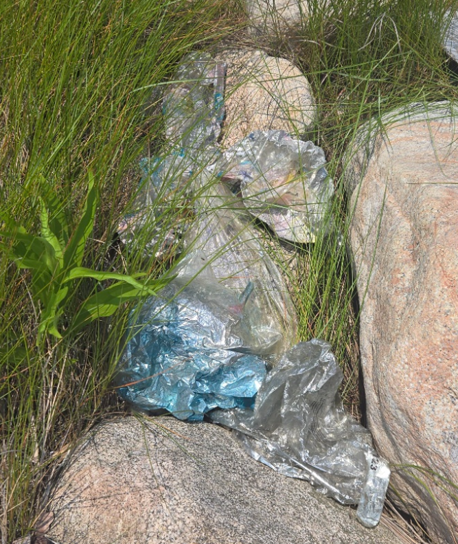
This is an important distinction. Michele’s work is not party cleanup. The marine debris she collects is washing in from the Sound and beyond, plastic bottles, fishing line, foam, rope, netting, and all kinds of materials that have traveled long distances before landing on our shores. This is a regional and global problem showing up on our doorstep, and having someone documenting and removing it consistently makes Fishers Island a meaningful part of the solution

That said, what people leave behind on the beach does matter too. Party mess, improperly extinguished fires, and trash left near the shoreline all add to the load and make an already hard job harder.

Summer on Fishers Island means bonfires, and we are not here to change that. But we do want to ask everyone to be responsible about it.

Earlier this season, pallets were burned on the platform at South Beach, leaving nails scattered across the area and creating a real hazard for people and wildlife. Pallet burning is not permitted on island beaches, and for good reason. At Race Point and South Beach, please make sure fires are fully extinguished before you leave.

A few simple things you can do:

  • Bring a pail to the beach and fill it with water before you start the fire
  • Use it to fully douse the coals when you are done
  • Never burn pallets, trash, bottles, or cans
  • Take everything you brought in back out with you

The simplest thing you can do is carry in, carry out. Whatever you bring to the beach, take it home. Every piece of trash that does not make it to a can has a way of ending up in the water eventually.

If you see debris washing up on a beach, you can report it to FI Conservancy or help remove it if it is safe to do so. And if you see someone burning trash or pallets on the beach, please say something.

These beaches are something worth protecting. Michele has been showing up for them for years. We hope you will too!

Learn more about our Marine Debris Cleanup Program here
July 2, 2026 146 views
Marine ReportsNews

Marine Debris Report – June 2026

by Anna White July 2, 2026

Marine Debris June 2026

beaches,

Total lbs = 1,473 / Total hours = 182.5
~ Michele Klimczak

DATEZONELOCATIONWEIGHT (LBS)HOURS
6/1/2026S3Beach before Big Club, Chocomount to farthest ends by Treasure Pond.628
6/2/2026S2Vikings End to Isabella Beach to Secret Beach.567.5
6/3/2026S2Wilderness Point beaches to South Beach, Sanctuary of Sands to Race Point.588.5
6/4/2026N1Airport beaches, ordinance, Ferry Park to Silver Eel Cove.375
6/5/2026N6Clay Point Rd. beaches to Brick Yard Rd. to Dock beach to Where the Wild Things Are through North Hill.488
6/7/2026N5Chocomount Cove beaches up to Hungry Point beaches.345
6/9/2026E4East Harbor to beaches north of Big Club Golf Course up to Latimer Light beaches.668.5
6/10/2026E4Latimer Light beaches through Castle to behind Money Pond and beach after Big Club beach.538
6/11/2026S3Beach before Big Club to Chocomount Beach.426
6/12/2026S2Isabella Beach, Secret Beach through far side of Vikings End (big pot).488.5
6/14/2026S2Wilderness Point to South Beach up to Sanctuary of Sands.416
6/15/2026N1Sanctuary of Sands to Race Point. Airport beaches to Ordinance to ferry Park to Silver Eel Cove to Little Stony Beach.508.5
6/16/2026N6North Hill beaches to Brick Yard Rd. beaches (tons of black buoys) to Clay Point. Road beaches to Dock Beach.618
6/17/2026N5Hungry Point beaches through Chocomount Cove beaches.437.5
6/18/2026E4Beach after Big Club beach, behind Money Pond to Castle.586
6/19/2026E4All Latimer Light beaches up through East Harbor over North side of Golf Course.738.5
6/21/2026S3Chocomount beaches.264
6/22/2026S2Isabella Beach through Vikings End through Wilderness Point beaches.498
6/23/2026S2South Beach through Sanctuary of Sands to Race Rock.347
6/24/2026N1Airport beaches to Ordinance, Ferry Park, Silver Eel Cove, Little Stony Beach, Holiday House beachesup to Tom's house.598
6/25/2026E4Latimer Light beaches around North side and Golf Course across from Big Club.636
6/26/2026N5Hungry Point beaches through Chocomount Cove beaches.527.5
6/27/2026N6Brick Yard Rd. beaches to Dock beaches to North Hil Rd. beaches (mess at South Beach from grad. Party).384
6/28/2026N6Clay Point Rd. beaches to Grey Gulls beaches.834
6/29/2026S3Beach befor Big club end to end of Chocomount. Nate Chaves came for 2.5 hours to drag tire, pots, hugs bags, trash!1868.5
6/30/2026E4Fire pits at Race and Buds Hole, is smoldering. Castle beaches through beaches behind Money Pond farthest end to beach after Big Club Beach.538

View Debris Photo Gallery Here!

July 2, 2026 155 views
NewsShorebirds

NEW: Introducing Shorebird Watch

by Anna White June 30, 2026

A NEW way for the community to follow along with the piping plovers, least terns, and oystercatchers nesting on island this season!

If you’ve ever walked the beach and wondered whether there are nesting birds nearby, or wished you could check in on how the chicks are doing without having to track us down, we built something just for you!

Shorebird Watch is a new page on our website where you can follow what’s happening with the island’s nesting shorebirds throughout the season, updated regularly by our team as we see it happen out in the field.

Why we created this

Protecting nesting shorebirds on Fishers Island has always been a community effort. Our staff and volunteers spend hours each week monitoring nests, but the truth is, the birds’ best chance at a successful season depends just as much on everyone walking these beaches every day. We know people care, and we know not everyone has an easy way to stay in the loop on what’s happening at any given moment. Shorebird Watch is our way of closing that gap and making sure the whole community has the information they need to help protect these birds, together.

What you’ll see on the page

The page gives a season-long look at our active monitoring sites, with regular updates on what’s happening at each one. You’ll find general activity updates, like when a site has active nests or young chicks present, along with simple notes on what kind of care that site might need from beach goers at that moment. We’ll be adding photos throughout the season as well, so the community can see a bit of what our team is seeing out in the field.

How it will be updated

Our team updates the page regularly throughout the breeding season, generally on a weekly basis, though timing may shift depending on what’s happening on the beach. Nesting season moves quickly, so we’ll do our best to keep things current as eggs hatch, chicks grow, and birds make their way toward fledging.

A note on how to use this page

We’re sharing this information so the community can make small, thoughtful choices, like giving a certain stretch of beach a little extra space, or choosing a different path for a dog walk during an especially sensitive window. This page is meant to help you stay informed, not to invite a visit to the nest itself. We ask that everyone please avoid seeking out or approaching any active nesting areas. Even well-meaning visits can disturb nesting birds, and the whole point of this page is to help protect them, not to create more activity around them.

A community effort

At the end of the day, conservation on Fishers Island only works because this community shows up for it. Shorebird Watch is one more way to keep everyone connected to that effort, and to make it just a little easier to be a good neighbor to the birds sharing our beaches this summer. We’re grateful for everyone who already gives these nesting areas the space they need, and we hope this page helps even more of our community feel like part of the work.

You can find Shorebird Watch on our Shorebird Monitoring page now, and we’ll continue adding updates and photos throughout the season.

Click Here to View

Featured Photo by Naomi Zahn 

June 30, 2026 161 views
Newer Posts
Older Posts

Upcoming Events

Notice
There are no upcoming events.

Keep in touch

Facebook Instagram Youtube

Recent Posts

  • An Invasive Spotted Lanternfly Was Found on Island – Time to Take Action!

  • June 2026 Breeding Bird Count

  • What to Do if You Find a Stranded Animal

  • Update on Phragmites Work and New Wetlands Regulations

  • SPOTTED in New London!

  • 2025 Fall Migratory Bird Count Results

  • Fall 2025 Migratory Bird Count

  • FIRST Summer Highlights 2025

  • Shorebirds Take Flight- The 2025 Season Wrap-Up

  • Buzz Be Gone- Final Spray of the Season

Explore

    • Home
    • Who We Are
    • What We Do
    • How To Help
    • News
    • Events

Connect

    • Join Us
    • Donate
    • Contact Us
Facebook Instagram Youtube
© 2026 All Right Reserved. Fishers Island Conservancy
Fishers Island Conservancy
  • Home
  • Who We Are
    • Our Mission
    • Our History
    • Our People
    • Contact Us
  • What We Do
    • Shorebird Monitoring
    • Annual Bird Counts
    • Marine Debris Clean Up
    • Island Sentinels
    • Research and Survey Team
    • Grassland Restoration
    • Mosquito Control
    • Invasive Plant Management
  • How To Help
    • Donate
    • Join Us
  • News
  • Events
    • Calendar